Mind the Earth: Earth’s changes seen through Google Earth
Exhibition
Nov 20, 2014 - Jan 31, 2015
The exhibition Mind the Earth at the Danish Architecture Center in 2014 showed the Earth’s changes through selected Google Earth images—providing insights into how diverse, resilient, but also vulnerable our planet is.
"Mind the Earth, mind it. Earth. My planet. Where I come from. I come from Earth. Mind that. Remind me about it."
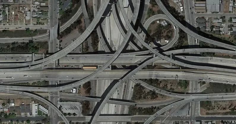
There is something deeply fascinating about seeing the Earth from above. Suddenly you notice things you were not previously aware of. From an altitude of 10 kilometres, landscapes and settlements create patterns, which we have no idea that we are part of. Then, when we zoom in, it becomes clear that every place and every region has its own unique character and story.
The exhibition, Mind the Earth, zoomed both in and out, as each of the selected photos from Google Earth told its own unique story about the state of the Earth: from scattered island communities to megacities and huge agricultural areas, which have to provide food for an ever growing population.
Facts and philosophy
The exhibition dealt with four main themes, all focused on living and inhabiting: food, energy, transport and water. Through those themes the exhibition examined what the future looks like for people, cities and landscapes: what are we going to live on? How will we get from A to B? And where will our resources come from?
Each photo was accompanied by surprising facts and thought-provoking philosophy. The exhibition was the result of a close collaboration between the architect/urban planner, Kasper Brejnholt Bak from Rambøll and the writer, Morten Søndergaard, each of whom has his own personal approach to the photos: on one hand, the architect’s descriptive, factual point of view; on the other, the writer’s poetic, philosophical one. Together they created sympathetic insight into the universe of the images, suggesting what our world looks like at the moment, and what it might end up looking like in the future.
Google Earth as a democratic tool
For some time now, Google Earth has proved its worth as a new democratic tool for viewing, and learning about our planet. But the really interesting question is: can a technological resource such as Google Earth provide us with new insights about the world we live in and maybe even help us change it? The exhibition, Mind the Earth will tackle this question with its combination of texts and selected photos from Google Earth.
Exhibitions Today
See Our Current Exhibitions
What was Mind the Earth?
Mind the Earth at the Danish Architecture Center presented the Earth’s changes through selected Google Earth images, highlighting the planet’s diversity, resilience and vulnerability.
When did Mind the Earth run at DAC?
The exhibition ran from 20 Nov 2014 to 31 Jan 2015.
What did the exhibition mean by “zooming in and out”?
It used Google Earth to reveal large-scale patterns from above and then zoom in to show each place’s distinct character and story about the planet’s condition.
What four themes structured the exhibition?
Mind the Earth was structured around four themes: food, energy, transport and water, with “how we inhabit” as the central lens.
Who developed the exhibition, and how were the images presented?
It was developed with architect and urban planner Kasper Brejnholt Bak (Rambøll) and writer Morten Søndergaard, with each image accompanied by both surprising facts and reflective philosophical text.
What should I know if I only read one thing?
Mind the Earth (20 Nov 2014–31 Jan 2015) used Google Earth imagery to combine facts and philosophy across food, energy, transport and water into a bigger story about living on Earth.